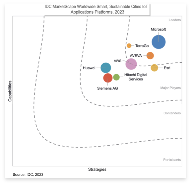


TerraGo Technologies today announced that Charlie Nobles has joined the company’s leadership team as Vice President of Sales, bringing decades of applied technology and utility operations expertise.
TerraGo Welcomes Charlie Nobles to Leadership Team to Further Strengthen Utility Operations and Technology Expertise